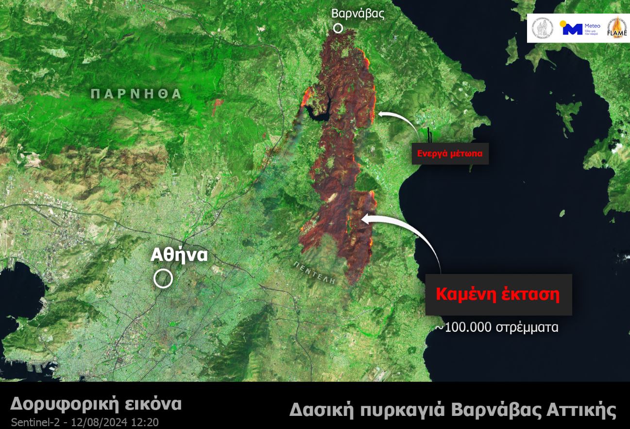
As of Monday afternoon, the fires have reached several populated areas, igniting homes in Penteli, Patima Vrilissiou, and Patima Chalandriou. Emergency alerts continue to be issued, with the latest evacuation orders affecting residents in Dionysos and Desi Geraka. A new blaze has also broken out in Ano Glyfada, further stretching firefighting resources.
The scale of destruction underscores the severity of the situation, as authorities and emergency services battle to contain the fires and protect lives and property. With the flames advancing into densely populated regions, the situation remains critical, and further evacuations are likely as the fires show little sign of abating.
______________________________________________
Are you seeking news from Greece presented from a progressive, non-mainstream perspective? Subscribe monthly or annually to support TPP International in delivering independent reporting in English. Don’t let Greek progressive voices fade.
Make sure to reference “TPP International” and your order number as the reason for payment.